
Nevada, United States
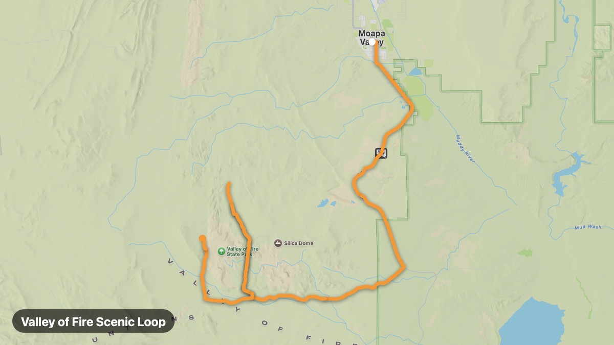
Valley of Fire Scenic Loop
Red sandstone formations in Nevada's oldest state park.
Overton → Mouse's Tank
- Distance
- 21 mi
- Level
- Easy
- Type
- Scenic
- Season
- October - April
Highlights
- Fire Wave
- Elephant Rock
- Red rock canyon
Must ride
★ 7.8/ 10
Risks
Fuel stops
Food stops
Ride it with RideCall
Find this route in the app, invite your group and track the ride.
More routes in Nevada
All routes in Nevada →Lake Tahoe Nevada Circle
Nevada side of Lake Tahoe with casino towns and beaches.
55 mi · Easy · Carson City → Incline Village
Red Rock Canyon Scenic Loop
Mojave Desert red cliffs minutes from the Las Vegas Strip.
27 mi · Easy · Las Vegas → Red Rock Canyon
Mount Rose Highway (NV-431)
Climb from Reno to 8,911-foot Mount Rose Summit.
29 mi · Medium · Reno → Mount Rose Summit
Great Basin National Park Route
Wheeler Peak and ancient bristlecone pines in remote eastern Nevada.
16 mi · Medium · Baker → Wheeler Peak
Pyramid Lake Scenic
Desert lake with tufa rock pyramid formation on Paiute land.
86 mi · Easy · Sparks → Nixon
Virginia City and Comstock Lode
Historic silver mining town on the Comstock Lode.
22 mi · Easy · Carson City → Virginia City