
Oklahoma, United States
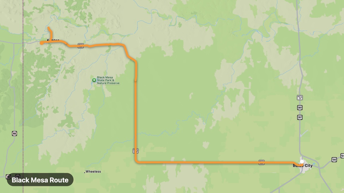
Black Mesa Route
Oklahoma's highest point in the panhandle mesa country.
Boise City → Kenton
- Distance
- 46 mi
- Level
- Easy
- Type
- Scenic
- Season
- April - November
Highlights
- Black Mesa
- Dinosaur tracks
- Panhandle solitude
Must ride
★ 8.0/ 10
Risks
TrafficTouristsPhoto stopsWildlifeSummer heat
Fuel stops
Boise CityBlack MesaKenton
Food stops
Black Mesa
Ride it with RideCall
Find this route in the app, invite your group and track the ride.
More routes in Oklahoma
All routes in Oklahoma →Red Carpet Country Route
Northwest Oklahoma gypsum hills and wide-open ranch land.
124 mi · Easy · Woodward → Guymon
Talimena Scenic Drive
Ridge-top drive through Ouachita National Forest.
70 mi · Medium · Talihina → Mena
Wichita Mountains Scenic Byway
Ancient granite peaks and bison in southwest Oklahoma.
25 mi · Easy · Lawton → Medicine Park
Route 66 Oklahoma
Mother Road through Tulsa, Oklahoma City, and western plains.
251 mi · Easy · Tulsa → Erick
Ouachita National Forest Loop
Pine forests and Broken Bow Lake in southeast Oklahoma.
15 mi · Medium · Broken Bow → Hochatown
Great Salt Plains Route
Salt flats and selenite crystal digging in north-central Oklahoma.
45 mi · Easy · Enid → Jet