
South Carolina, United States
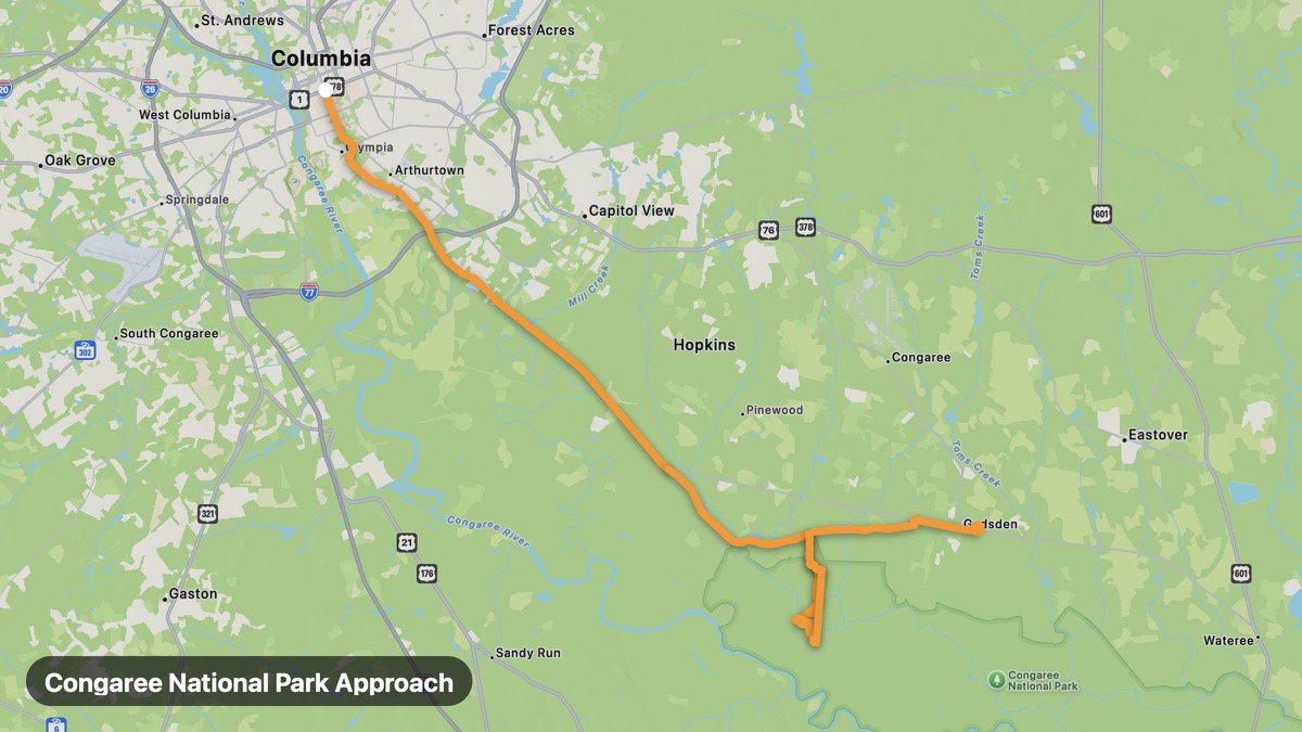
Congaree National Park Approach
Old-growth bottomland forest near Columbia.
Columbia → Gadsden
- Distance
- 63 mi
- Level
- Easy
- Type
- Scenic
- Season
- October - May
Highlights
- Congaree NP
- Champion trees
- Boardwalk trail
Must ride
★ 7.7/ 10
Risks
Fuel stops
Food stops
Ride it with RideCall
Find this route in the app, invite your group and track the ride.
More routes in South Carolina
All routes in South Carolina →Cherokee Foothills Scenic Highway
SC-11 loop at the base of the Blue Ridge Escarpment.
109 mi · Medium · Gaffney → Walhalla
Blue Ridge Escarpment Route
Dramatic escarpment views in Mountain Bridge Wilderness.
25 mi · Medium · Caesars Head → Jones Gap
Lowcountry US-17 Coastal
Live oaks and antebellum plantations along the ACE Basin.
113 mi · Easy · Charleston → Beaufort
Francis Marion Forest Loop
Coastal plain forest and swamp between Charleston and Myrtle Beach.
61 mi · Easy · Moncks Corner → Awendaw
Caesars Head State Park Route
Steep climb to escarpment overlook above Greenville.
10 mi · Medium · Cleveland → Symmes Chapel
Edisto Island Scenic
Unspoiled barrier island with live oaks and marshes.
9 mi · Easy · Edisto Beach → Botany Bay