
Idaho, United States
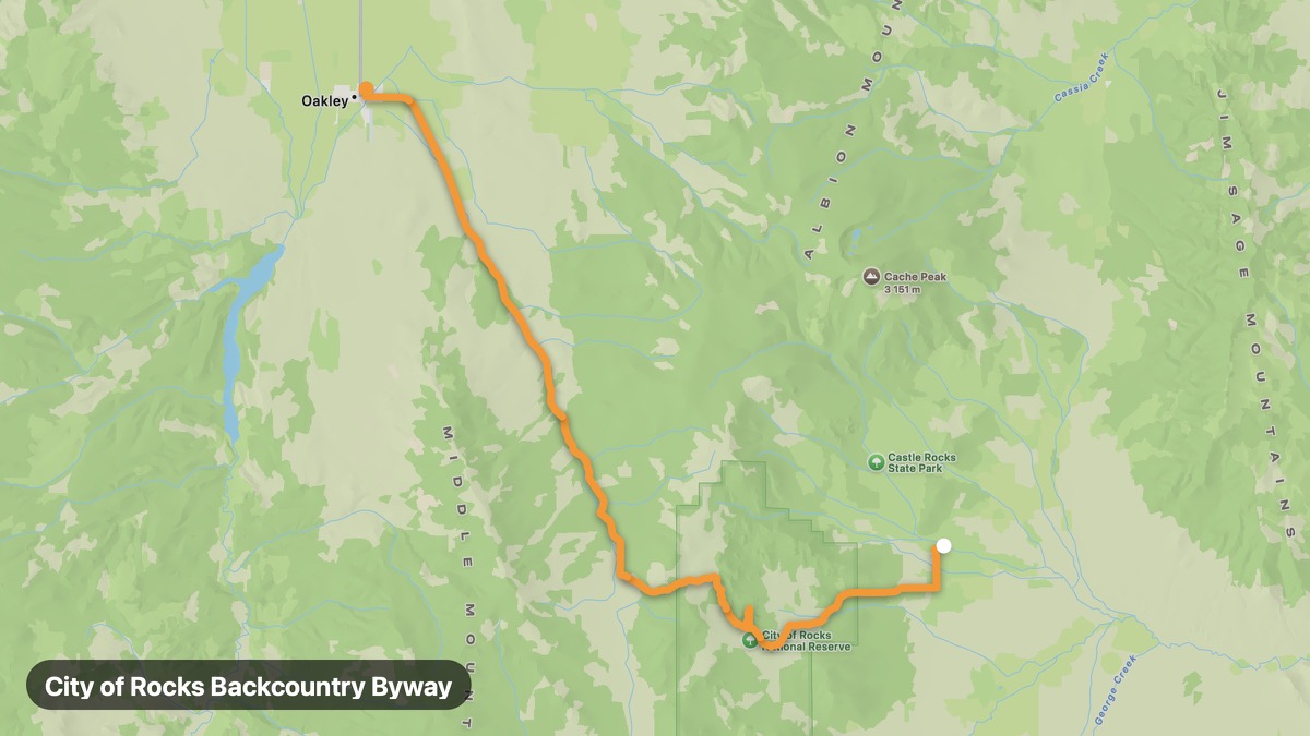
City of Rocks Backcountry Byway
Granite spires and pioneer wagon ruts in south Idaho.
Almo → Oakley
- Distance
- 30 mi
- Level
- Easy
- Type
- Scenic
- Season
- May - October
Highlights
- City of Rocks
- Granite formations
- California Trail history
Must ride
★ 7.7/ 10
Risks
Fuel stops
Food stops
Ride it with RideCall
Find this route in the app, invite your group and track the ride.
More routes in Idaho
All routes in Idaho →Sawtooth Scenic Byway
Dramatic Sawtooth Range views on ID-75 through central Idaho.
65 mi · Medium · Stanley → Ketchum
Lochsa River Scenic Byway (US-12)
Wild and Scenic Lochsa River canyon through Clearwater National Forest.
100 mi · Medium · Kooskia → Lolo Pass
Salmon River Scenic Byway
River of No Return country through the Frank Church Wilderness.
117 mi · Medium · Salmon → Stanley
Teton Scenic Byway
Grand Teton views from the Idaho side of the Tetons.
40 mi · Easy · Ashton → Driggs
Snake River Canyon Scenic
Snake River Canyon and Shoshone Falls on the edge of the Snake River Plain.
45 mi · Easy · Twin Falls → Hagerman
Sun Valley Loop
Ketchum and Sun Valley resort country mountain loop.
49 mi · Medium · Hailey → Galena Summit