
Utah, United States
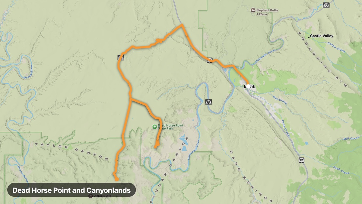
Dead Horse Point and Canyonlands
Colorado River gooseneck overlook above Canyonlands.
Moab → Island in the Sky
- Distance
- 50 mi
- Level
- Easy
- Type
- Gorge
- Season
- March - November
Highlights
- Dead Horse Point
- Island in the Sky
- Shafer Trail overlook
Must ride
★ 7.7/ 10
Risks
Gravel sectionsTight cornersTrafficWildlifeSummer heat
Fuel stops
MoabDead Horse PointIsland in the Sky
Food stops
Dead Horse Point
Ride it with RideCall
Find this route in the app, invite your group and track the ride.
More routes in Utah
All routes in Utah →Bryce Canyon to Zion Route
Connect two iconic Utah parks via scenic UT-9.
116 mi · Medium · Bryce Canyon → Zion NP
Nebo Loop National Scenic Byway
Mount Nebo and Utah Valley panoramas on paved loop.
63 mi · Medium · Nephi → Payson
Dinosaur Diamond Prehistoric Highway
Dinosaurs and deep canyons on the Colorado border.
153 mi · Easy · Vernal → Harper Corner
Utah Scenic Byway 12
All-American Road through red rock canyons and high plateaus.
131 mi · Medium · Panguitch → Torrey
Monument Valley Tribal Park Loop
Iconic Navajo Nation buttes on the 17-mile valley drive.
26 mi · Easy · Mexican Hat → Visitor Center
Mirror Lake Scenic Byway
Uinta Mountains highest paved road to 10,687 feet.
26 mi · Medium · Kamas → Bald Mountain Pass